Are there court cases or buyer complaints on this project?
Locked
Cases on the land
Cases on the builder
RERA complaints
Builder's other projects
Filed onCase no.Filed atWhat it's aboutStatus
₹ ••,•••
•• %
•• ••• ••••
Contract & costs
What does a buyer commit to?
We haven't verified this for this project yet.
Sign in first, then it is one click.
Not verified yet: Forfeiture, agreement; Forfeiture, allotment letter; Transfer fee; Maintenance included; Agreement and allotment letter; Payment plan; Agreement for sale.
Valuation
What is it worth?
We haven't verified the rest of this yet.
Sign in first, then it is one click.
This project
Unit sizes
Floor plans, brochure
No floor plans on file
Unsold stock
K-RERA inventory
Sold, Q2 2026-27
122 / 122
Unsold, Q2 2026-27
0
Location & risks
What is the location like?
Review1 to review · 1 clear
Groundwater, taluk average11.4 m below groundYelahanka taluk, July 2023
Water supply, as filedSelf developmentDeclared by the promoter
Metro, operational6.0 kmYeshwantpur
Construction & progress
How is it being built, and when will it be ready?
Review1 to review · 1 clear
Completion76%As of Q2 2026-27, promoter's return
Progress
Completion, as the promoter reported it
Developer
Can the developer deliver?
Clear2 clear
Cost left₹113.55 CrAs of Q2 2026-27
Sold122 / 122✓ClearClear
Sold in Q2 2026-270✓ClearClear
Funding
Estimated cost
Loan & collateral
Can it be financed?
Conditions
Collateral checks
Escrow bank
HDFC · Richmond Road
Stage
Progress as reported, by quarter
Data room
Documents filed for this project
Locked
148 documents filed with K-RERA for this project
DocumentFolderPagesFiled
₹ ••,•••
•• %
•• ••• ••••
•••••
₹ •.•• Cr
•• of ••
₹ ••,•••
•• %
Unlock this full report
₹99 for this report opens Title & ownership, Disputes & cases and Documents for this project, yours to read for good.
Unlock this full report₹99 for this report · opens Title & ownership, Disputes & cases and DocumentsUnlock
Survey plots · KGIS cadastral
Imagery: Esri, Vantor, Earthstar Geographics
Survey plots around the filed site pin, on satellite imagery. The outlines are the land of each survey number, not buildings. Survey plots around the filed site pin. This project's survey numbers are not matched to them yet, so no plot is marked as its land.
I had given 5 stars while purchasing a unit here; but the failure of the builder to stick to their committed timeline is forcing me to give it a 1 star. There are no updates from the builder regarding possession, only that useless…
AAnkit Timbadia7 Nov 2025★★★★★
Update, post the reply from Adarsh CRM has stopped sending monthly progress reports. 2) We are in touch with CRM, but are getting no answers on OC application or application for RERA phase 2. Only way to move forward and put pressure it to…
Ddillip Babu5 Dec 2023★★★★★
Worst sales team I have ever seen, may be as per them 90% project sold out ( as per them ) that's why they are arrogant to explain the project details. They won't even respond to the basic questions. No respect to customers.p The roads in…
Everything here is as filed by the promoter with Karnataka RERA or as recorded in Bhoomi land records, and can be stale or wrong at source. Verify against certified records before you transact. Open Adarsh Crest in the interactive atlas
Not verified yet
Boundaries
Schedule in the EC vs KGIS neighbours
Not verified yet
Encumbrance certificate, Form 15
Survey sketch
Survey sketch filed with K-RERA
Not verified yet
Sketch, sanction and mutation vs KGIS map
Not verified yet
Land record
Survey plots · KGIS cadastral
Filing vs KGIS map
•• ••• ••••
•••••
₹ •.•• Cr
•• of ••
The RTC of each filed survey
Not verified yet
Ownership
Share of sales revenue
Not verified yet
Joint development agreement
Not verified yet
Unlock this full report
₹99 for this report opens Title & ownership, Disputes & cases and Documents for this project, yours to read for good.
Valid as of this reportValidity ended
Approval letters
Power NOC
Filed with the registration
Fire NOC (1 of 2)
KSFES/NOC/1004/2018 · building height 53.3 m (Block 1)
✓Clear
Fire NOC (2 of 2)
building height 53.3 m (Block 1)
✓Clear
Environmental clearance
SEIAA 42 CON 2017 · issued 20 Apr 2017
✓Clear
Airport height NOC
issued 31 Jan 2018 · permissible top elevation 960 m above mean sea level · validity ended 30 Jan 2026
Pollution board (CFE)
Filed with the registration
Water supply NOC
Filed with the registration
RERA
K-RERA
RERA extensions
Applied for · Applied 31 Dec 2025
RERA completion date
31 Dec 2025
Registration certificates
PRM/KA/RERA/1251/446/PR/211022/004369
Not verified yet: Building plan, Land conversion, Conversion order.
•••••
₹ •.•• Cr
•• of ••
Unlock this full report
₹99 for this report opens Title & ownership, Disputes & cases and Documents for this project, yours to read for good.
The area
Comparable projects
Filed prices nearby
Basemap: Esri, OpenStreetMap contributors
Map of 5 projects within 4 km of the site that have a price confirmed from their Form 4 certificate: Assetz Soho & Sky, price locked; Lodha Mirabelle, price locked; Assetz Soho & Sky Phase 1b, price locked; Sumadhura Epitome, price locked; Sumadhura Solea, price locked.
This project
Padlock: that project's price is part of its own report
Not verified yet: Recent price, super built-up; Recent price, carpet; Phase 1 → Phase 2; Gross yield, per sq ft; Price per sq ft, super built-up; Form 4 certified totals; Agreements in the Form 4 sold list; Carpet vs rest, by type; Unit mix filed; Unit types; Transactions in this project; North Bengaluru, past year; Bengaluru, past year; North Bengaluru since 2022; This project vs North Bengaluru; By quarter; Registered sale price per sq ft, by year; Transactions around this project; Carpet price, projects within 4 km; Bengaluru median yield.
The site
Zoning & hazards
Power lines, drains and flood locations
Basemap: Esri, OpenStreetMap contributors
Map of the ground within about 900 m of the site, showing high-tension power lines, storm drains and government-flagged flood locations.
Land · ₹56.57 Cr 21.2%Development · ₹210.04 Cr 78.8%
Form 4
Estimated cost, at registration
₹266.61 Cr
Cost left
₹113.55 Cr
Sales
Sold vs unsold, Q2 2026-27
Sold (122) 100%
Sold per quarter
K-RERA inventory
Sold, Q3 2025-26
112 / 122 · 10 available
Sold, Q4 2025-26
122 / 122 · 0 available
Sold, Q1 2026-27
122 / 122 · 0 available
Sold, Q2 2026-27
122 / 122 · 0 available
Unsold, Q2 2026-27
0
Sold in Q4 2025-26
10
Sold in Q1 2026-27
0
Sold in Q2 2026-27
0
Compliance
Escrow, Q2 2026-27
Escrow and filings
Escrow bank
HDFC · Richmond Road
Designated account, collected
₹180.70 Cr in Q2 2026-27
Designated account, withdrawn
₹132.45 Cr in Q2 2026-27 (73% of that quarter's deposits)
Track record
Average schedule slip
DOSL builder track
K-RERA registrations under this promoter
33
Marked completed
4
Past promised date, not completed
15
Other phases under this promoter name
4
With a filed extension or completion
3 (1 completed, 2 extended)
Average schedule slip
42 months
Not verified yet: Receivable, sold flats; Cost left vs buyer dues; Cost incurred; Collected from buyers; Land cost revision; Unregistered agreements, over 10% paid.
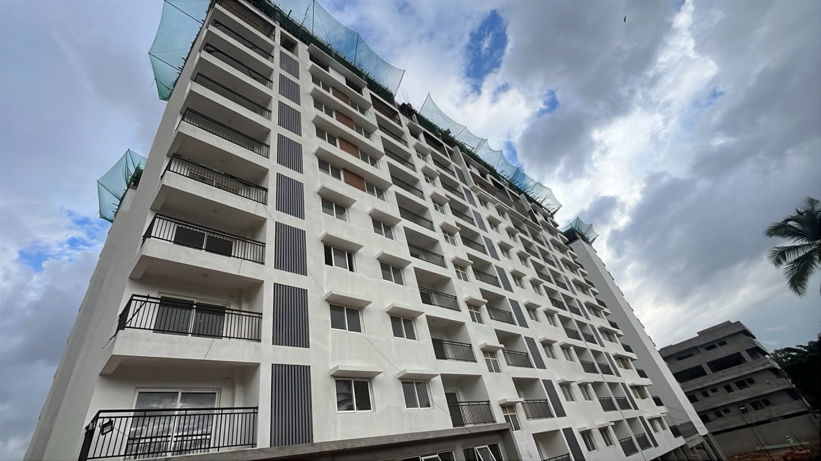
Site photos, Q1 2026-27
Not verified yet: Value; Max loan; Borrower margin; Developer's project loan; Example unit; Calculation; Records searched to; Building plan; Unregistered agreements, over 10% paid; Sale deed in favour of.
Basemap: Esri, OpenStreetMap contributors
Map of drains, lakes, metro, high-tension lines and government-flagged flood locations within 3 km of the site, with rings at 1 km and 3 km.
Yelahanka taluk average, July 2023: 11.4 m below ground
What it means
10-20 m below ground, a class in CGWB's depth-to-water-level classes. In the pre-monsoon of 2025, 0 of 1 CGWB wells in Yelahanka taluk read in this class
Through the year
January 2025: 3.8 m (1 well), Pre-monsoon 2025: 3.4 m (1 well), August 2025: 0.1 m (1 well), depth below ground of CGWB's monitoring wells in Yelahanka taluk (the median where there are several)
Water supply, as filed
Self development
Nearest city water main
630 m
Distances
Within 3 km
Basemap: Esri, OpenStreetMap contributors
Map of drains, lakes, metro, high-tension lines and government-flagged flood locations within 3 km of the site, with rings at 1 km and 3 km.