Are there court cases or buyer complaints on this project?
Locked
Cases on the land
Cases on the builder
RERA complaints
Builder's other projects
Filed onCase no.Filed atWhat it's aboutStatus
₹ ••,•••
•• %
•• ••• ••••
Contract & costs
What does a buyer commit to?
We haven't verified the rest of this yet.
Sign in first, then it is one click.
Forfeiture, allotment letterNot found
Transfer feeNot found
Cancellation
Agreement and allotment letter
Forfeiture, allotment letter
Not found
Payments
Payment plan
Not found
Agreement for sale
Valuation
What is it worth?
We haven't verified the rest of this yet.
Sign in first, then it is one click.
This project
Unit sizes
Floor plans, brochure
No floor plans on file
Unsold stock
K-RERA inventory
Sold, Q2 2026-27
574 / 1,344
Unsold, Q2 2026-27
770
Months to sell, derived from filed bookings
69 months
The area
Location & risks
What is the location like?
Groundwater, taluk average16.9 m below groundBengaluru South taluk, July 2023
Water supply, as filedSelf developmentDeclared by the promoter
The site
Flooding
Site vs nearest drain
Construction & progress
How is it being built, and when will it be ready?
Review1 to review · 1 clear
Completion99%As of Q2 2026-27, promoter's return
Progress
Completion, as the promoter reported it
Developer
Can the developer deliver?
Clear1 clear
Sold574 / 1,344As of Q2 2026-27
Sold in Q2 2026-2738✓ClearClear
Funding
Estimated cost
Loan & collateral
Can it be financed?
Conditions
Collateral checks
Escrow bank
INDIAN OVERSEAS BANK · Appareddypalaya-ISRO View Branch
Stage
Progress as reported, by quarter
Data room
Documents filed for this project
Locked
101 documents filed with K-RERA for this project
DocumentFolderPagesFiled
₹ ••,•••
•• %
•• ••• ••••
•••••
₹ •.•• Cr
•• of ••
₹ ••,•••
•• %
Unlock this full report
₹99 for this report opens Disputes & cases and Documents for this project, yours to read for good.
Unlock this full report₹99 for this report · opens Disputes & cases and DocumentsUnlock
Survey plots · KGIS cadastral
Imagery: Esri, Vantor, Earthstar Geographics
Survey plots around the locality centre named in the filing, on satellite imagery. The outlines are the land of each survey number, not buildings. The filing names only the locality, so the marker is the locality centre, not the site. The survey plots around it are shown for orientation only; this project's survey numbers are not matched to them yet.
First of all, I would like to thank Mr. Vishwanath and Mr. Lawrence for their support throughout the sales journey. The backend and site teams at Gopalan Olympia have been equally prompt, supportive, and positive. It’s this overall…
AAisha Darjee10 Sep 2026★★★★★
The community at Gopalan Olympia is really good. All the festivals are celebrated beautifully, and with more than 500 families staying in the community, it has a very lively and friendly atmosphere. The clubhouse also has almost everything…
Bbhargav saikia29 Aug 2026★★★★★
Very good apartment at reasonable price. Staff is very cordial and responsible specially Vishwanath who helped me out in every aspect. The CRM team is ok ok. The campus and amenities are very good but feel like lot of space in clubhouse is…
Everything here is as filed by the promoter with Karnataka RERA or as recorded in Bhoomi land records, and can be stale or wrong at source. Verify against certified records before you transact. Gopalan Olympia is not plotted on the interactive atlas: its filing gives no coordinate precise enough to place a single building, only the surrounding locality.
Survey sketch
Survey sketch filed with K-RERA
No survey sketch is listed on this phase's K-RERA filing
Land record
Survey plots · KGIS cadastral
Imagery: Esri, Vantor, Earthstar Geographics
Survey plots around the locality centre named in the filing, on satellite imagery. The outlines are the land of each survey number, not buildings. The filing names only the locality, so the marker is the locality centre, not the site. The survey plots around it are shown for orientation only; this project's survey numbers are not matched to them yet.
Not verified yet: Records searched to; Charges on the land; Landowner share of sales; How the land reached this project; Court-case search; High Court order; Charges; Schedule in the EC vs KGIS neighbours; Sketch, sanction and mutation vs KGIS map; Area on the KGIS map; The RTC of each filed survey; Share of sales revenue; Joint development agreement.
Filed with the registration
RERA
K-RERA
RERA extensions
Granted · Approved 22 Dec 2020
RERA completion date
31 Dec 2026
Registration certificates
PRM/KA/RERA/1251/310/PR/171208/000986
EX/PRM/KA/RERA/1251/310/PR/201222/000986
Not verified yet: Building plan, Land conversion, Validity, Conversion order.
•••••
₹ •.•• Cr
•• of ••
Unlock this full report
₹99 for this report opens Disputes & cases and Documents for this project, yours to read for good.
Due on signing
Not found
Late-payment interest
Not found
Interest the builder pays on late possession
Not found
Fees
Agreement for sale
Transfer fee
Not found
Holding charge
Not found
Not verified yet: Forfeiture, agreement; Maintenance included; Due within 15 days; Each construction stage; Floors in payment plan.
Not verified yet: Recent price, super built-up; Recent price, carpet; Phase 1 → Phase 2; Gross yield, per sq ft; Price per sq ft, super built-up; Form 4 certified totals; Agreements in the Form 4 sold list; Carpet vs rest, by type; Unit mix filed; Unit types; Transactions in this project; West Bengaluru, past year; Bengaluru, past year; West Bengaluru since 2022; This project vs West Bengaluru; By quarter; Registered sale price per sq ft, by year; Transactions around this project; Carpet price, projects within 4 km; Filed prices nearby; Median rent, 3 km; Rents and yields; Months to sell unsold stock; K-RERA inventory.
Nearest storm drain
about 2.5 km from the locality centre, primary drain
Nearest lake, tank or pond
about 0.5 km from the locality centre, an unnamed pond
Amenities
Specification and Form 5
Club House, built
100%
Electricity, built
60%
Outdoor Sports facility, built
100%
Swimming Pool, built
100%
Parks, built
60%
Water and Sanitation, built
60%
Around it
Water
Groundwater, Bengaluru South taluk average
Ten-year July mean for this taluk: 23.2 m
Taluk average; not a reading at the site.
Water at a glance
Groundwater
Bengaluru South taluk average, July 2023: 16.9 m below ground
What it means
10-20 m below ground, a class in CGWB's depth-to-water-level classes. In the pre-monsoon of 2025, 0 of 10 CGWB wells in Bengaluru South taluk read in this class
Through the year
January 2025: 2.2 m (5 wells), Pre-monsoon 2025: 1.9 m (10 wells), August 2025: 1.5 m (11 wells), depth below ground of CGWB's monitoring wells in Bengaluru South taluk (the median where there are several)
Water supply, as filed
Self development
Distances
Approximate: locality level
Nuisances
Distance from the site
Locality only filed: no distance from the site to show
DOSL nuisance layer
Landfill or waste transfer station
None within 3 km of the locality centre
Sewage treatment plant
about 2 km from the locality centre, named STP-6 on OpenStreetMap
Quarry
None within 3 km of the locality centre
Crematorium
None within 3 km of the locality centre
Prison
None within 3 km of the locality centre
Electrical substation
about 0.5 km from the locality centre, named Kambipura Substation on OpenStreetMap
Not verified yet: Metro, operational; Power lines, flood-prone areas, drains; Planning and hazards; Drains and lakes; Kitchen handover; Sewage plant; Power backup; Nearest city water main; Ground level; Metro, under construction; Road distance from the site; Six city anchors · OSRM, no traffic.
As the promoter reported it
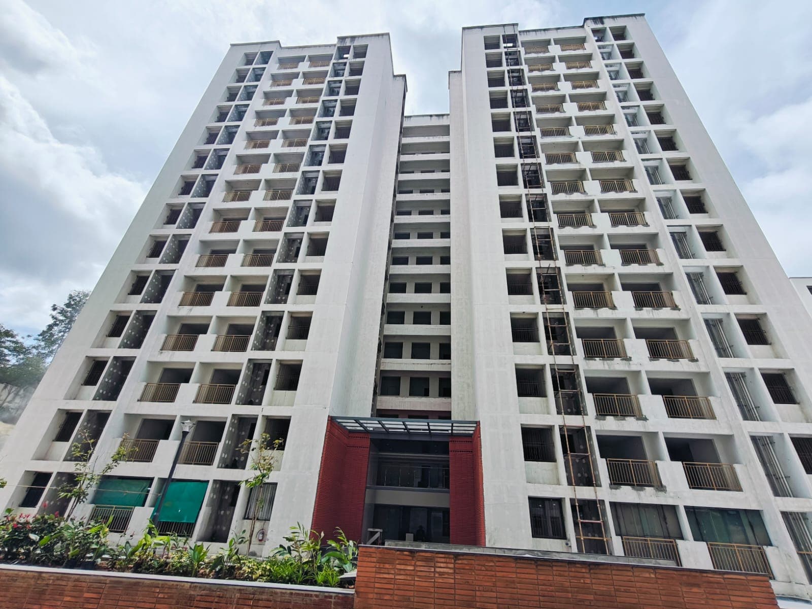
Site photos filed with K-RERA, Q2 2026-27
Work left
By component, Q2 2026-27
Quarterly return, Q2 2026-27
Main structure
100% · planned by 25 Apr 2020
Electrical and plumbing finishing
75% · planned by 15 May 2020
Club house
100%
Completion
99%
Dates
Dates
Filed dates
Schedule end
15 May 2020
RERA completion date
31 Dec 2026
!Review
Work began, as filed
1 Dec 2015
Specified structure
Specification sheet, page 1
Page 1
Page 1 of the specification sheet. The promoter filed this with the registration.
Form 6 · Jan 2026, Jun 2026, Jul 2026, Oct 2026 (4 filed)
✓Clear
Fire safety
Filed with the registration
Environmental clearance
Filed with the registration
Architect, quarterly
Form 5 · Jan 2026, Jun 2026, Jul 2026, Oct 2026 (4 filed)
Chartered accountant, Form 4
Dated 15 Jan 2026
Not verified yet: Possession, agreement; Structure; Structural safety certificate; Internal roads; Completion, accountant; What the promoter specified · not an inspection; Specification sheet · brands "or equivalent"; Design consultants (Form 6).
Land · ₹9.79 Cr 2.5%Development · ₹385.00 Cr 97.5%
Form 4
Estimated cost, at registration
₹394.79 Cr
Sales
Sold vs unsold, Q2 2026-27
Sold (574) 42.7%Unsold (770) 57.3%
Sold per quarter
K-RERA inventory
Sold, Q3 2025-26
473 / 1,344 · 871 available
Sold, Q4 2025-26
500 / 1,344 · 844 available
Sold, Q1 2026-27
536 / 1,344 · 808 available
Sold, Q2 2026-27
574 / 1,344 · 770 available
Unsold, Q2 2026-27
770
Sold in Q4 2025-26
27
Sold in Q1 2026-27
36
Sold in Q2 2026-27
38
Compliance
Escrow, Q2 2026-27
Escrow and filings
Escrow bank
INDIAN OVERSEAS BANK · Appareddypalaya-ISRO View Branch
Designated account, collected
₹20.68 Cr in Q2 2026-27
Designated account, withdrawn
₹27.45 Cr in Q2 2026-27
Share of collections deposited in escrow
100%
Track record
Average schedule slip
DOSL builder track
Other phases under this promoter name
3
With a filed extension or completion
3 (1 completed, 2 extended)
Average schedule slip
28 months
Not verified yet: Receivable, sold flats; Cost left; Cost left vs buyer dues; Cost incurred; Collected from buyers; Land cost revision; Unregistered agreements, over 10% paid.
Site photos, Q2 2026-27
Not verified yet: Value; Max loan; Borrower margin; Developer's project loan; Example unit; Calculation; Records searched to; Building plan; Unregistered agreements, over 10% paid; Sale deed in favour of.
Basemap: Esri, OpenStreetMap contributors
Map centred on the locality the filing names, approximate: locality level. The filing names only the locality. The marker is its centre and the ring is 5 km; it does not mark the site.
Map centred on the locality the filing names, approximate: locality level. The filing names only the locality. The marker is its centre and the ring is 5 km; it does not mark the site.